


By combining high resolution visual data, precise mapping, and repeatable aerial workflows, drone inspections provide construction teams with faster insights, reduced risk, and better cost control throughout every phase of a project.
Traditional Construction Monitoring
Pain Points
Limitations of Traditional Methods
No consistent overhead view of the entire site
Progress photos lack scale and spatial accuracy
Manual measurements are slow and labour-intensive
Limited ability to compare changes over time
Increased costs due to rework, delays, and miscommunication
Modern Drone Inspection
Solution
The Drone Inspection Advantage
Rapid capture of complete site data in minutes
Accurate 2D and 3D mapping without disrupting work
Repeatable workflows for consistent documentation
Reduced labour and surveying costs
Improved coordination between teams and stakeholders
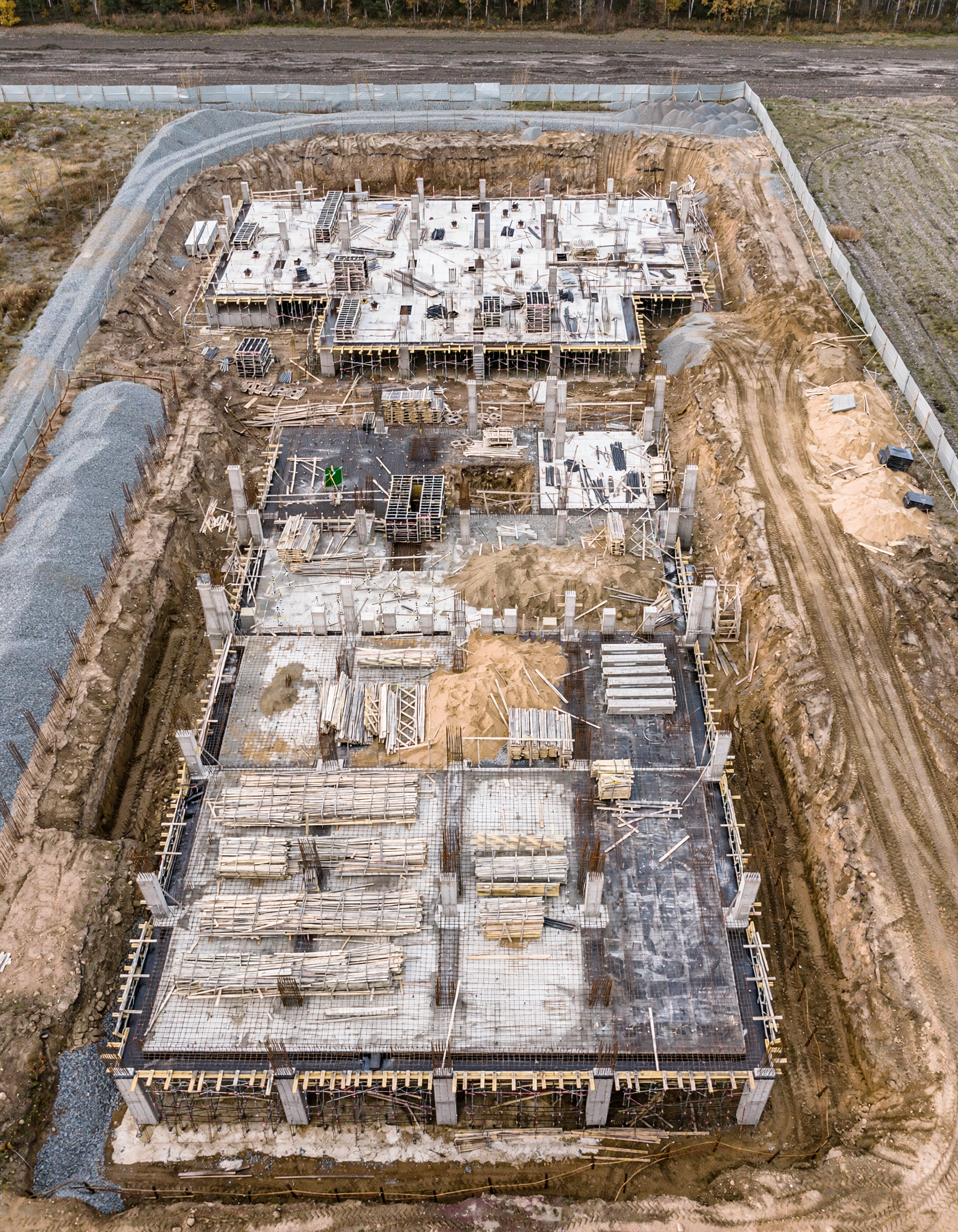
High Resolution Visual Inspection, Mapping & 3D Site Models
Our construction drone services go beyond photography. We provide accurate visual inspections, 2D site maps, and 3D models that support planning, progress tracking, and decision-making throughout the project lifecycle.
Each operation follows a structured flight plan to capture consistent, repeatable data suitable for mapping and modeling workflows.
What this service provides:
High resolution visual inspections of active construction sites
2D orthomosaic site maps for accurate overhead reference
3D site models for progress visualization and coordination
Consistent data capture for comparisons over time
Clear documentation suitable for engineers, project managers, and stakeholders
Workflow:
Site assessment and mission planning
Automated aerial data capture across the site
Processing of imagery into maps and 3D models
Delivery of visual assets and documentation

Progress Monitoring, Mapping & Cost Control
Traditional progress tracking relies on site walks, photos, and manual reporting. These methods are time-consuming, inconsistent, and often incomplete.
Drone based mapping allows construction teams to capture accurate, site wide data in a single flight, reducing labour costs and improving visibility.
What this service provides:
Repeatable 2D and 3D data sets for progress tracking
Orthomosaic maps for layout verification and coordination
Visual comparison between site visits
Reduced need for frequent on site walkthroughs
Improved budget control by identifying issues earlier